Paddling the Chesapeake: Janes Island Water Trails
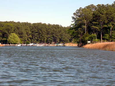
Janes Island State Park has a number of great water trails to explore in a kayak. Katie and I took a trip here early in the 2006 paddling season. The launch site is located in Janes Island State Park, and I have included GPS coordinates of the launch site (N 38° 0.585' W 75° 50.878'). A map to this location is available from Google Maps by clicking here. The Janes Island Marina has a floating dock available for launching kayaks and offers kayak and canoe rentals.
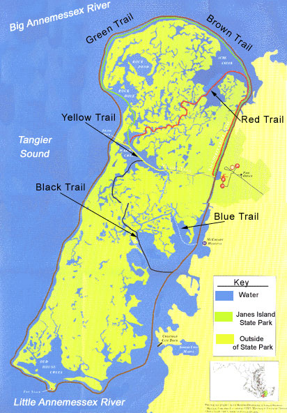
The Janes Island State Park is a bit of a drive from the Baltimore Washington area, but the paddling here is quite different from other places on the Chesapeake Bay. The water here is salt water, and the shores are mostly fine sand or tall grasses. Katie and I started our paddling trip by heading north from the launch site. This is following the red, green and brown trails. The wind was from the North Northwest between 10 and 15 knots, so even in the channel we felt the effects of the wind. I have copied a picture from the Department of Natural Resources web page showing the water trails. The red trail follows the coast on the left hand side. We continued paddling along the green and brown trails toward the open water. We reached the narrow beach and took a quick break to stretch our legs.
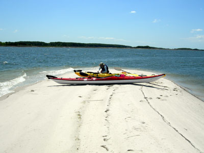
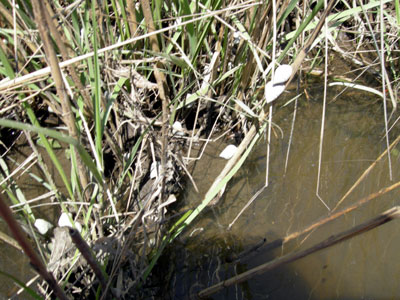
We decided to explore the inlet before heading along the green and brown trails. Once we moved into the tall grasses the effects of the wind almost disappeared. This made for some relaxing paddling that is similar to the Blackwater Wildlife Refuge. We found periwinkle snails climbing the grasses to stay out of the water. They are easy to find if you look for them and I have included a picture below. We zigzagged around the tall grasses for approximately an hour before we decided to continue our paddle around Janes Island. We found a narrow beach where we could easily walk our kayaks across the sand to reach the open water.
Once we were back on the open water, the effects of a 15-knot wind with a large fetch made paddling difficult. Our desired path was almost exactly perpendicular to the wind that was making waves with whitecaps. Since taking waves athwartship (perpendicular to the centerline) makes a kayak unstable, we took the waves at an angle kind of like a sailboat tacking to go upwind. Our progress was initially slow, but as we worked our way around the northern section of Janes Island, we were able to paddle with the wind. Riding the waves was great fun and allowed us to zip along the coast. We continued to follow the green trail around the northern section of Janes Island and returned to the boat launch. On this return it would have been easy to take the blue or black trail as a detour instead of the direct return to the boat launch we selected.
My GPS ran out of batteries during this trip, so I replaced them after I noticed. Our total recorded mileage was 8.8 miles, but the actual trip was likely slightly more than 10 miles. The Department of Natural Resources web page lists the green trail as 4 miles, so it was easy to increase the length of this trail with a little exploring. This webpage also lists the brown trail as 5 miles. Looking at the map, I think this is likely a typo since it appears to be more than twice the length of the green trail.
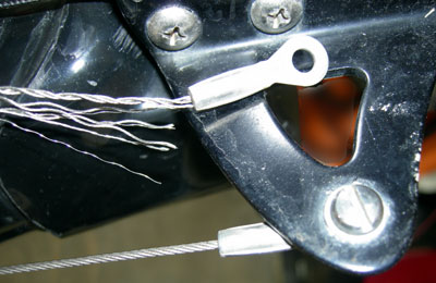
As we were loading the kayaks on the car, I noticed that the cable to my kayak rudder was almost completely frayed. It is a good thing that it did not break since both foot pegs would be useless if the cable broke. It is always a good idea to inspect a rudder or skeg before any paddling trip even if you do not regularly use it. Check out my page on rudders and skegs for more information.