Paddling the Chesapeake: Mariner Point
Mariner Point Park is located near Baltimore and provides a great access point to paddle the Gunpowder River and Days Cove. Mariner Point Park is managed by Harford County Parks and Recreation and provides parking, boat ramps, and bathroom facilities. The Park can be found on 100 Kerney Dr in Joppa Maryland 21085. To get directions to this point, please click here to launch Google Maps in a separate window. For further information about the park please click here to open the Mariner Point Park web page.
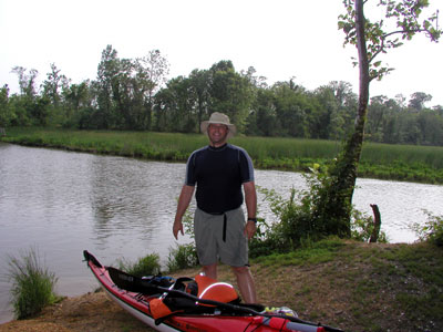
Once inside the park, drive past the powerboat ramp and into the parking lot for the trailers. Between the parking lot and the water is a grassy area where the boats can be unloaded and launched into the water through a narrow opening in the trees. This grassy area has a low section that is often wet. I have marked the launch site on my GPS (coordinates N 39° 24.054' W 76° 21.049').
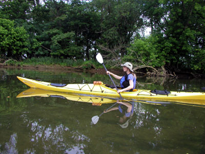
I started my paddling headed south (to the left) from the launch site and followed the shore on the same side as the launch site. As my map shows, we paddled around the peninsula along a narrow stream headed north. This section of the trip was mostly private docks and beautiful homes. We saw a Dad and his Son catch a fairly large fish (relative to the boy). Great job tiger!
We turned around and headed downstream and crossed the mouth of the inlet with the launch site. Use caution at this point since this is where the powerboats are leaving the no wake zone and heading out to the Chesapeake Bay. Do not go near the train tracks on the north shore. This region is part of the Aberdeen Proving Grounds and is controlled by the military. They do not tolerate trespassing and they confiscate boats in their water.
We wrapped around the peninsula and followed the coast and reached a point slightly east of the launch site. The water here is pretty shallow making the boat traffic minimal. There are occasional fishing boats and jet skis. We followed the shore on the right hand side and reached an open area. On our way, we stopped to stretch our legs and get a snack and we met up with a park ranger. He mentioned that part of this region used to be a sand mine. The operation would remove sand until water filled in the area and then moved on. A hurricane came through this area and connected all the ponds with the storm surge. This leveled out the area and made mining more difficult.
On our way back, we continued to follow the shore on the right hand side. We found a long east-west section that is less than three feet deep. The actual depth depends on the tide, but for the most part this is fairly shallow with a sandy bottom. This trip shown on the map does not reach the Days Cove, but continuing east on this section and heading south will lead back to the open water. Following the coast on the right hand side will lead to Days Cove. There are numerous small side paths that can be followed. Many of these passages are extremely shallow and are often only a couple of inches deep. These are great places to explore.
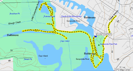
In a kayak, it is often difficult to see over the tall grasses and get an overview of the area. While paddling it is always a good idea to track progress on a map. As an additional safety precaution, I carry a Garmin GPS that includes maps of the coastline. I used the downloaded track in the map shown above. For additional information on my GPS, check out this link on my web site.